c

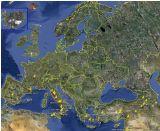
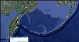
WELT VULKAN KARTEN/ REGION: KAMCHATKA HALBINSEL ALEUTISCHE INSELN

WORLD VOLCANO MAP/ REGION: KAMCHATKA PENINSULA/ ALEUTIAN ISLANDS

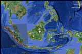
please be patient... this page with its large map needs some time to load..

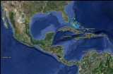
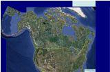
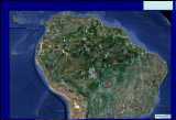
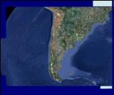
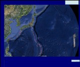
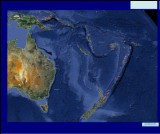
other regional maps: (click on the small images)

           
HOME
internal Weather, Earthquake and volcano sites
UCT timec zones
EXTERNAL LINKS

quick links to local volcano survey institutes around the world for latest informations:

USA ALASKA KAMCHATKA AUSTRALIA JAPAN PHILIPPINES INDONESIA CONGO ERITREA
CVO AVO KVERT ROVO/ RVO VAAC/ JMA PHIVOLCS CVGHM VAAC MODIS
 
ITALY ICELAND CANARIES MEXICO GUATEMALA EL SALVADOR COSTA RICA: NICARAGUA: MONTSERRAT:
INGV-CT NVC/ IMO IGN (Spain) CENAPRED INSIVUMEH SNET OVSICORI INETER MVO
 
COLUMBIA: ECUADOR: CHILE: HAWAII: VANUATU: PAPUA NEW GUINEA:   VAAC  
INGEOMINAS IGEPN SERNAGEOMIN link VGO GEONET/NZ      
Smithsonian page Vulkane.net deutsch volcano-discovery- english Solar Terrestrial Activity Report MODVOLC; Hawaii

5

central_america
kamchatka


maintainance for new appearance -COMPLETED /last update: 20230212

FEATURES:

> high resolution maps with all known volcanoesworlswide divided into regional maps

> complete list with links to the US Smnithsonian database with basic information and activity reports.

click on the volcano name in the column titled GOOGLE EARTH". The link will offer you an executable kmz. download file based on GPS data. right click and open it with Google Earth. The program will start and navigate you automatically in the fly modus to the volcano site . if you worry about virus: you c an always check any file -just right click and scan iit with your antivirus program. The feature requires the installation of the programm Google Earth.

> webcams (must be updated links oftenly change) other features such as famous ancient sites might be implemented or follow

.


0


Nr
name/USGS datalink:
geographical location long./lat.
international volcano number:
type Status
find volcano on Google Earth**

volcano webcam:

others

01 MASHKOVTSEV              
02 KAMBALNY              
03 KOSHELEV              
04 YAVINSKY              
05 DIKY GREBEN              
06 KURILE LAKE              
07 ILYINSKY              
08 ZHELTOVSKY              
09 KELL              
10 BELENKAYA              
11 KSUDACH              
12 OZERNOY              
13 OLKOVIY VOLCANIC GROUP              
14 KHODUTKA              
15 PIRATKOVSKY              
16 OSTANETS              
17 OTDELNIY              
18 GOLAYA              
19 ASACHA              
20 VISOKIY              
21 MUTNOVSKY              
21 GORELY              
23 OPALA              
24 UNNAMED              
25 TOLMACHEV DOL              
26 VILYUCHIK              
27 BARKHATNAYA SOPKA              
28 UNNAMED              
29 UNNAMED              
30 BOLSHE-BANNAYA              
31 KORYAKSKY              
32 AVACHINSKY              
33 DZENZURSKY              
34 ZHUPANOVSKY
53.59°N/ 159.147°E
300120
Shield Volcano*
CO
 
1959
35 VEER              
                     
Explanations
links
 
           
** about the Google Earth feature:
Hi* = historical
C* = Caldera
T* = Tephrochronology
Ho* = holocene   R* = Radiocarbon


Nr
name/USGS datalink:
geographical location long./lat.
international volcano number:
type Status
find volcano on Google Earth**

volcano webcam:

others

53°50'0"N/ 158°3'0"E
1000-122
 
Ho*
   
53°54'18"N/ 158°4'0"E
1000-123
 
T*
   
53°54'18"N/ 158°23'6"E
1000-124
 
R*
   
53°59'0"N/ 159°27'0"E
1000-125
 
Hi*
   
54°3'0"N/ 159°27'0"E
1000-13=
 
Hi*
   
54°8'0"N/ 159°40'0"E
1000-14=
 
Hi*
   
54°19'0"N/ 160°1'0"E
1000-15=
 
R*
   
54°32'0"N/ 159°48'0"E
1000-16=
 
R*
   
54°30'0"N/ 159°58'0"E
1000-17=
 
R*
   
54°29'12"N/ 160°15'12"E
1000-18=
 
R*
   
54°35'36"N/ 160°16'24"E
1000-19=
 
R*
   
47 54°45'12"N/ 160°31'36"E
1000-20=
 
Hi*
   
48 54°55'0"N/ 160°38'0"E
1000-201
 
Ho*
   
49
54°58'24"N/ 160°42'6"E
1000-21=
 
T*
   
50
55°1'54"N/ 160°43'12"E
1000-22=
 
R*
   
51
55°4'0"N/ 160°46'0"E
1000-221
 
R*
   
52
55°7'48"N/ 160°19'0"E
1000-23=
Stratovolcano
Hi*
53
55°55'0"N/ 161°45'0"E
1000-232
 
Ho?
   
54
55°49'48"N/ 160°19'48"E
1000-24=
Shield volcano
Hi*
   
55
55°45'18"N/ 160°31'36"E
1000-241
 
Ho*
   
56
55°51'42"N/ 160°36'12"E
1000-242
 
Ho
   
55°58'42"N/ 160°35'12"E
1000-25=
Stratovolcano
Hi*
56°1'0"N/ 160°35'36"E
1000-251
 
Ho*
   
56°3'24"N/ 160°38'18"E
1000-26=
Stratovolcano
Hi*
56°4'13"N/ 160°28'12"E
1000-261
 
Hi*
   
56°39'12"N/ 161°21'36"E
1000-27=
 
Hi*
54°45'0"N/ 157°23'0"E
1000 272
 
R*
   
55°33'0"N/ 157°28'0"E
1000-273
 
R*
   
55°41'0"N/ 157°44'0"E
1000-28=
 
Hi*
   
55°49'0"N/ 157°59'0"E
1000-29=
 
Ho?
   
55°53'0"N/ 157°47'0"E
1000-30-
 
Ho?
   
55°12'0"N/ 158°28'0"E
1000-31-
 
Ho?
   
55°25'0"N/ 167°20'0"E
1000-271
 
T*
   
55°26'0"N/ 158°39'0"E
1000-32-
 
Ho?
   
55°35'0"N/ 158°23'0"E
1000-33
 
Ho?
   
  SARYCHEV PEAK                  
Explanations
links
 
           
** about the Google Earth feature:
Hi* = historical
C* = Caldera
T* = Tephrochronology
Ho* = holocene   R* = Radiocarbon


register card- volcanoes- RUSSIA/ KAMCHATKA ISLAND- 71- 114:

Nr

name/USGS datalink:

geographical location long./lat.

international volcano number:

type

Status

find volcano on Google Earth**

volcano webcam:

others

71 ROMANOVKA 55°39'0"N/ 158°48'0"E 1000-34-   Ho?* ROMANOVKA Stratovolcano    
72 UKSICHAN 56°5'0"N/ 158°23'0"E 1000-35-   Ho?* UKSICHAN Shield volcano    
73 BOLSHOI-KEKUKNAYSKY 56°28'0"N/ 157°48'0"E 1000-36-   R* BOLSHOI-KEKUKNAYSKY Shield volcanoes    
74 KULKEV 56°22'0"N/ 158°22'0"E 1000-37-   Ho?* KULKEV Shield volcano    
75 GEODESISTOY 56°20'0"N/ 158°40'0"E 1000-38-   Ho?* GEODESISTOY Shield volcano    
76 ANAUN 56°19'0"N/ 158°50'0"E 1000-39-   Ho?* ANAUN Stratovolcano    
77 KRAINY 56°22'0"N/ 159°2'0"E 1000-40-   Ho?* KRAINY Shield volcano    
78 KEKURNY 56°24'0"N/ 158°51'0"E 1000-41-   Ho?* KEKURNY Shield volcanoes    
79 EGGELLA 56°34'0"N/ 158°31'0"E 1000-42-   Ho?* EGGELLA Shield volcano    
80 UNNAMED 56°49'0"N/ 158°57'0"E 1000-43   Ho?* UNNAMED Shield volcano (3)    
81 VERKHOVOY 56°31'0"N/ 159°32'0"E 1000-44   Ho?* VERKHOVOY Shield volcano    
82 ALNEY-CHASHAKONDZHA 56°42'0"N/ 159°39'0"E 1000-45   R* ALNEY-CHASHAKONDZHA Stratovolcano    
83 CHERNY 56°49'0"N/ 159°40'0"E 1000-46   Ho?* CHERNY Stratovolcano    
84 POGRANYCHNY 56°51'0"N/ 159°48'0"E 1000-47   Ho?* POGRANYCHNY Shield volcanoes    
85 ZAOYZERNY 56°53'0"N/ 159°57'0"E 1000-48   Ho?* ZAOZERNY Shield volcanoes    
86 BLIZNETS 56°58'0"N/ 159°47'0"E 1000-49   Ho?* BLIZNETS Stratovolcano    
87 KEBENEY 57°6'0"N/ 159°56'0"E 1000-50   Ho?* KEBENEY Shield volcano    
88 FEDOTYCH 57°8'0"N/ 160°24'0"E 1000- 51   Ho?* FEDOTYCH Shield volcano    
89 SHISHEIKA 57°9'0"N/ 161°5'0"E 1000-511   R* SHISHEIKA Lava dome    
90 TERPUK 57°12'0"N/ 159°50'0"E 1000-512   R* TERPUK Shield volcano    
91 SEDANKINSKY 57°16'0"N/ 160°5'0"E 1000-52-   E* SEDANKINSKY Shield volcano    
92 LEUTONGEY 57°18'0"N/ 159°50'0"E 1000-53-   Ho?* LEUTONGEY Shield volcano    
93 TUZOVSKY 57°19'0"N/ 159°58'0"E 1000-54   Ho?* TUZOVSKY Shield volcano    
94 GORNY INSTITUTE 57°20'0"N/ 160°12'0"E 1000-550   R* GORNY INSTITUTE Stratovolcano    
95 KINENIN 57°21'0"N/ 160°58'0"E 1000-551   R* KINENIN Maar    
96 BLIZNETSY 57°21'0"N/ 161°22'0"E 1000-552   R* BLIZNETSY Lava cone    
97 TITILA 57°24'0"N/ 160°6'0"E 1000-56-   R* TITILA Shield volcano    
98 MEZHDUSOPOCHNY 57°28'0"N/ 160°15'0"E 1000-57   Ho?* MEZHDUSOPOCHNY Shield volcano    
99 SHISHEL 57°27'0"N/ 160°22'0"E 1000-58   Ho?* SHISHEL Shield volcano    
100 ELOVSKY 57°33'0"N/ 160°32'0"E 1000-59-   T* ELOVSKY Shield volcanoes    
101 ALNGEY 57°42'0"N/ 160°24'0"E 1000-60   Ho?* ALNGEY Stratovolcano    
102 UKA 57°42'0"N/ 160°35'0"E 1000-61   Ho?* UKA Schield volcano    
103 KAILENEY 57°48'0"N/ 160°40'0"E 1000-62   Ho?* KAILENEY Schield volcano    
104 PLOSKY 57°50'0"N/ 160°15'0"E 1000-63   Ho?* PLOSKY Schield volcano (2)    
105 BELY 57°53'0"N/ 160°32'0"E 1000-64   Ho?* BELY Schield volcanoes    
106 NYLGIMELKIN 57°58'0"N/ 160°39'0"E 1000-65   R* NYLGIMELKIN Shield volcano    
107 SNEZHNIY 58°1'0"N/ 160°48'0"E 1000-66   Ho?* SNEZHNIY Shield volcano    
108 IKTUNUP 58°5'0"N/ 160°46'0"E 1000-67   Ho?* IKTUNUP Shield volcanoes    
109 SPOKOINY 58°8'0"N/ 160°49'0"E 1000-671   R* SPOKOINY Stratovolcano    
110 OSTRY 58°11'0"N/ 160°49'0"E 1000-68-   Ho* OSTRY Stratovolcano    
111 SNEGOVOY 58°12'0"N/ 160°58'0"E 1000-69   Ho?* SNEGOVOY Shield volcano    
112 SEVERNY 58°17'0"N/ 160°52'0"E 1000-70   R* SEVERNY Shield volcano    
113 IETTUNUP 58°24'0"N/ 161°5'0"E 1000-71   Ho?* IETTUNUP Shield volcanoes    
114 VOYAMPOLSKY 58°22'0"N/ 160°37'0"E 1000-72   Ho?* VOYAMPOLSKY Shield volcanoes    
                     
Explanations
links
 
           
** about the Google Earth feature:
Hi* = historical
C* = Caldera
T* = Tephrochronology
Ho* = holocene   R* = Radiocarbon


register card- volcanoes- ALEUTIAN ISLANDS- NR- 01-41

(activity updates on regional map of Northern America)

Nr

name and coordinates /USGS datalink:

international volcano number:

Status

find volcano on Google Earth**

volcano webcam:

others

01 BULDIR pos 52°21'0"N/ 175°54'38"E 1101-01- Ho?* BULDIR- Stratovolcano    
02 KISKA pos 52°6'10"N/ 177°36'7"E 1101-02 Hi* KISKA Stratovolcano    
03 SEGULA pos 52°0'55"N/ 178°8'8"E 1101-03 Ho* SEGULA Stratovolcano    
04 DAVIDOF pos 51°58'0"N/ 178°20'0"E 1101-04 Ho?* DAVIDOF Stratovolcano    
05 LITTLE SITKIN pos 51°57'0"N/ 178°32'35"E 1101-05 Hi* LITTLE SITKIN- Stratovolcano    
06 SEMISOPOCHNOI- pos 51°56'0"N/ 179°35'0"E 1101-06 Hi* SEMISOPOCHNOI Stratovolcano    
07 GARELOI- pos 51°47'25"N/ 178°47'38"W 1101-07 Hi* GARELOI Stratovolcano    
08 TANAGA- pos 51°53'6"N/ 178°8'45"W 1101-08 Hi* TANAGA Stratovolcano    
09 TAKAWANGHA- pos 51°52'22"N/ 178°0'20"W 1101-09 R* TAKAWANGHA Stratovolcano    
10 BOBROF- pos 51°54'36"N/ 177°26'18"W 1101-10 Ho?* BOBROF Stratovolcano    
11 KANAGA- pos 51°55'22"N/ 177°10'4"W 1101-11 Hi* KANAGA Stratovolcano    
12 MOFFETT- pos 51°56'38"N/ 176°44'48"W 1101-111 R* MOFFETT Stratovolcano    
13 ADAGDAK- loc 51°59'16"N/ 176°35'30"W 1101111A PHS* ADAGDAK Stratovolcano    
14 GREAT SITKIN- loc 52°4'34"N/ 176°7'48"W 1101-12- Hi* GREAT SITKIN Stratovolcano    
15 KASATOCHI- loc 52°10'39"N/ 175°30'30"W 1101-13- Hi* KASATOCHI Stratovolcano    
16 KONIUJI- loc 52°13'0"N/ 175°8'0"W 1101-14- ArAr*
KONIUJI Stratovolcano    
17 SERGIEF- pos 52°3'0"N/ 174°57'0"W 1101-15- u* SERGIEF Stratovolcano    
18 ATKA- pos 52°19'54"N/ 174°8'12"W 1101-16 Hi* ATKA Stratovolcanoes    
19 KOROVIN 52°22'52"N/ 174°9'15 1101-161 Hi* KOROVIN Stratovolcanoes    
20 SEGUAM- pos 52°18'55"N/ 172°30'35"W 1101-18- Hi* SEGUAM Stratovolcanoes    
21 AMUKTA- pos 52°30'0"N/ 171°15'8"W 1101-19 Hi* AMUKTA Stratovolcano    
22 CHAGULAK- pos 52°34'36"N/ 171°8'0"W 1101-20 Ho* CHAGULAK Stratovolcano    
23 YUNASKA- pos 52°38'34"N/ 170°37'43"W 1101-21 Hi* YUNASKA Schield volcano    
24 HERBERT- pos 52°44'32"N/ 170°6'38"W 1101-22 Ho* HERBERT Stratovolcano    
25 CARLISLE- pos 52°53'38"N/ 170°3'15"W 1101-23 Hi* CARLISLE Stratovolcano    
26 CLEVELAND- pos 52°49'30"N/ 169°56'38"W 1101-24 Hi* CLEVELAND Stratovolcano  
27 TANA- pos 52°50'0"N/ 169°46'0"W 1101-241 Ho* TANA Stratovolcanoes    
28 ULIAGA- pos 53°3'54"N/ 169°46'0"W 1101-25- Ho* ULIAGA Stratovolcano    
29 KAGAMIL- pos 52°58'25"N/ 169°43'0"W 1101-26- Hi* KAGAMIL Stratovolcano    
30 VSEVIDOF- pos 53°7'48"N/ 168°41'35"W 1101-27 Hi* VSEVIDOF Stratovolcano    
31 RECHESCHNOI- pos 53°9'24"N/ 168°32'20"W 1101-28 Ho* RECHESCHNOI Stratovolcano    
32 OKMOK- pos 53°26'0"N/ 168°8'0"W 1101-29 Hi* OKMOK Schield volcano    
33 BOGOSLOF- pos 53°56'0"N/ 168°2'0"W 1101-30 Hi* BOGOSLOF submarine volcano    
34 MAKUSHIN- pos 53°53'27"N/ 166°55'22"W 1101-31 Hi* MAKUSHIN Stratovolcano    
35 AKUTAN- pos 54°8'4"N/ 165°59'10"W 1101-32 Hi* AKUTAN Stratovolcano  
36 WESTDAHL- pos 54°31'6"N/ 164°39'0"W 1101-34 Hi* WESTDAHL Stratovolcano    
37 FISHER- pos 54°39'0"N/ 164°26'0"W 1101-35- Hi* FISHER Stratovolcano    
38 SHISHALDIN- pos 54°45'20"N/ 163°58'0"W 1101-36 Hi* SHISHALDIN Stratovolcano  
39 ISANOTSKI- pos 54°45'54"N/ 163°43'21"W 1101-37 u* ISANOTSKI Stratovolcano    
40 ROUNDTOP- pos 54°48'0"N/ 163°35'20"W 1101-38 R* ROUNDTOP Stratovolcano    
41 AMAK- pos 55°25'26"N/ 163°8'57"W 1101-39 Hi* AMAK Stratovolcano    
links> Alaska Division of Geological & Geophysical Surveys. Alaska Volcano Observatory
Explanations
links
u*= uncertain
   
PHS* = Pleistocene Hot Springs
ArAr* =
** about the Google Earth feature:
Hi* = historical
C* = Caldera
T* = Tephrochronology
Ho* = holocene   R* = Radiocarbon

KKK

KKK

Index volcanoes-Alaska peninsula((green numbers)

(activity updates on regional map of Northern America)

Nr
Name/USGS datalink:
volcano number:
volcano type:
find volcano on Google Earth**
volcano webcam:
others
01 1102-01 Stratovolcano Ho* FROSTY    
02 DUTTON- pos 55°10'5"N/ 162°16'18"W
1102-001
Stratovolcano Ho* DUTTON    
03 EMMONS LAKE- pos 55°20'26"N/ 162°4'43"W 1102-02 Caldera Ho* EMMONS LAKE    
04 PAVLOF- pos 55°25'0"N/ 161°53'15"W 1102-03 Stratovolcano Hi* PAVLOF  
05 PAVLOF SISTER- pos 55°27'10"N/ 161°50'35"W 1102-04 Stratovolcano Ho* PAVLOF SISTER    
06 DANA- pos 55°38'28"N/ 161°12'50"W 1102-05 Stratovolcano R* DANA    
07 STEPOVAK BAY 2- pos 55°54'45"N/ 160°2'27"W 1102-051 Cinder Cones Ho* STEPOVAK BAY 2    
08 STEPOVAK BAY 3- pos 55°55'45"N/ 160°0'7"W 1102-052 Cinder Cones Ho?* STEPOVAK BAY 3    
09 STEPOVAK BAY 4- pos 55°57'15"N/ 159°57'15"W 1102-053 Stratovolcano P* STEPOVAK BAY 4    
10 KUPREANOF- pos 56°0'40"N/ 159°47'50"W 1102-06- Stratovolcano Hi* KUPREANOF    
11 VENIAMINOF- pos 56°10'0"N/ 159°23'0"W 1102-07- Stratovolcano Hi* VENIAMINOF  
12 BLACK PEAK- pos 56°33'9"N/ 158°47'5"W 1102-08- Stratovolcano R* BLACK PEAK    
13 ANIAKCHAK- pos 56°53'0"N/ 158°10'0"W 1102-09- Caldera Hi* ANIAKCHAK    
14 YANTARNI- pos 57°1'7"N/ 157°11'6"W 1102-10- Stratovolcano T* YANTARNI    
15 CHIGINAGAK- pos 57°8'6"N/ 156°59'24"W 1102-11- Stratovolcano Hi* CHIGINAGAK    
16 KIALAGVIK- pos 57°12'10"N/ 156°44'43"W 1102-12- Stratovolcano Ho* KIALAGVIK    
17 UGASHIK-PEULIK- pos 57°45'3"N/ 156°22'5"W 1102-13- Stratovolcano Hi* UGASHIK-PEULIK  
18 UKINREK MAARS- pos 57°49'54"N/ 156°30'35"W 1102-131 Maars Hi* UKINREK MAARS    
19 UNNAMED- pos 57°52'0"N/ 155°25'0"W 1102-132 Lava Dome Ho* UNNAMED    
20 MARTIN- pos 58°10'20"N/ 155°21'40"W 1102-133 Stratovolcano Hi* MARTIN    
21 MAGEIK- pos 58°11'41"N/ 155°15'10"W 1102-15- Stratovolcano R* MAGEIK    
22 TRIDENT- pos 58°14'8"N/ 155°6'0"W 1102-16- Stratovolcano Hi* TRIDENT    
23 KATMAI- pos 58°16'47"N/ 154°57'48"W 1102-17- Stratovolcano Hi* KATMAI  
24 NOVARUPTA- pos 58°16'0"N/ 155°9'24"W 1102-18- Caldera Hi* NOVARUPTA    
25 GRIGGS- pos 58°21'14"N/ 155°5'30"W 1102-19- Stratovolcano E* GRIGGS    
26 SNOWY MOUNTAIN- pos 58°20'8"N/ 154°40'55"W 1102-20- Stratovolcano R* SNOWY MOUNTAIN    
27 DENISON- pos 58°25'4"N/ 154°26'57"W 1102-21- Stratovolcano Ho?* DENISON    
28 STELLER- pos 58°26'0"N/ 154°24'0"W 1102-22- Stratovolcano Ho* STELLER    
29 KUKAK- pos 58°27'10"N/ 154°21'18"W 1102-23- Stratovolcano F* KUKAK    
30 KAGUYAK- pos 58°36'30"N/ 154°1'40"W 1102-25- Lava Domes Ho* KAGUYAK    
31 FOURPEAKED- pos 58°46'12"N/ 153°40'20"W 1102-26- Stratovolcano Hi* FOURPEAKED  
32 DOUGLAS- pos 58°51'19"N/ 153°32'31"W 1102-27- Stratovolcano Ho* DOUGLAS    
links> Alaska Division of Geological & Geophysical Surveys. Alaska Volcano Observatory
Explanations
links
   
             
** about the Google Earth feature:
Hi* = historical
Us= Uranium series C* = Caldera  
F* = Fumarolic R* = Radiocarbon